You are using an out of date browser. It may not display this or other websites correctly.
You should upgrade or use an alternative browser.
You should upgrade or use an alternative browser.
- Thread starter kisi3l3k
- Start date
A map can't be large enough for a quality map of this size.
You would have better results in making many maps of different areas.
As for the automatic thing, i guess you can simply take a heightmap with good quality and creating a map out of it using a mapping program such as dragon, or i think Sythen made a program in which you can build a map out of a heightmap, not sure.
Last edited:
Which version of dragon are you using?
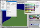
And did you check for color problems. I remember when I did maps with photoshop or stuff it caused some nice problems like minor color difference problems or other stuff...
And did you check for color problems. I remember when I did maps with photoshop or stuff it caused some nice problems like minor color difference problems or other stuff...
Eri might be right, I always forget that Dragon is really critical in using the right indexiation.... Try it 

